Sigrid got a much needed bath. We paid extra for the bug wash – it was VERY necessary No compromising photos, we’re not those kind of parents.
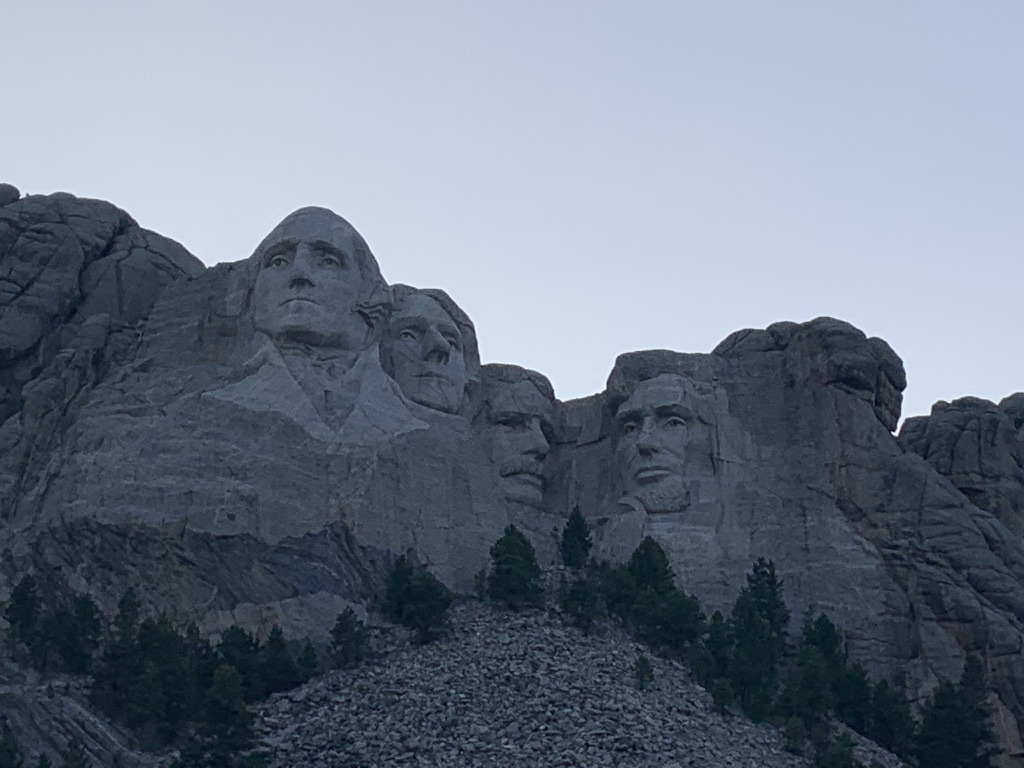
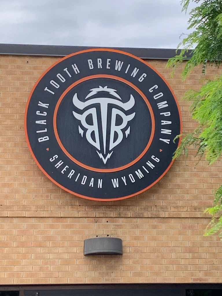
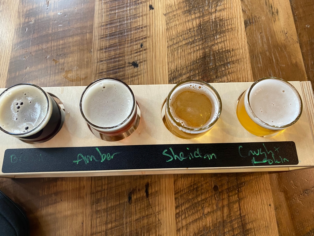
After a grueling 20 mile drive, we arrived in Rapid City! Known as the City of Presidents! Why you ask?Because of these life size statues! E with President Washington!President Jefferson!President Lincoln!FDR!JFK!Our Habitat for Humanity Patron, President Carter!President Clinton!President Obama – only recently installed!Aptly named since it’s in an old firehouse!Our taster of all their beers including their house made root beer!Menu! In the photo above, the back row is represented by the left hand side of the menu and the front row is represented by the right side of the menu!There aren’t enough superlatives for the beer and experience at this brewery!Excellent! All of it!Tasting room with a view of the brewing equipment!Yes, they barrel age some of their beers! Some in wine barrels and some in bourbon barrels! The bourbon barrel aged Scotch Ale was excellent!E’s taster!
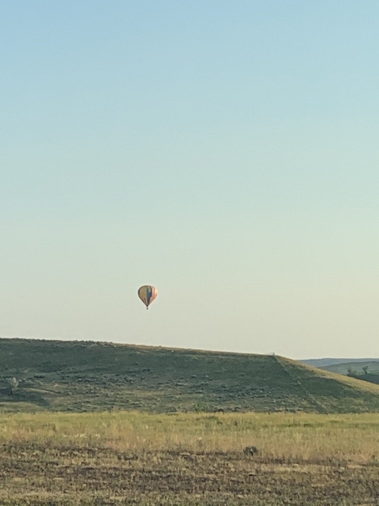
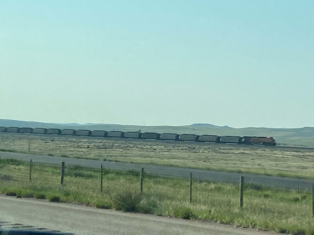
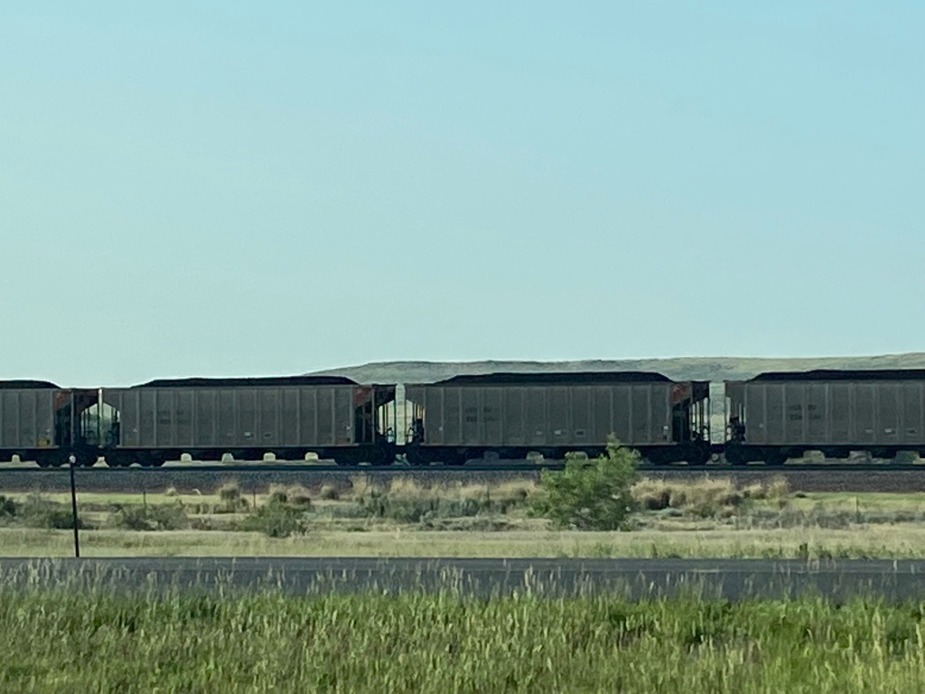
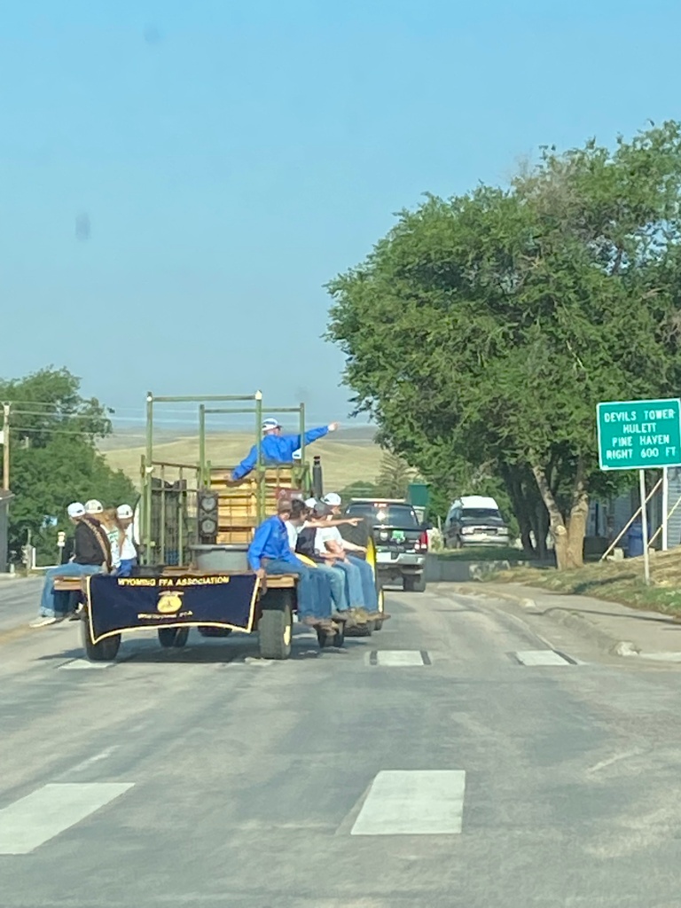
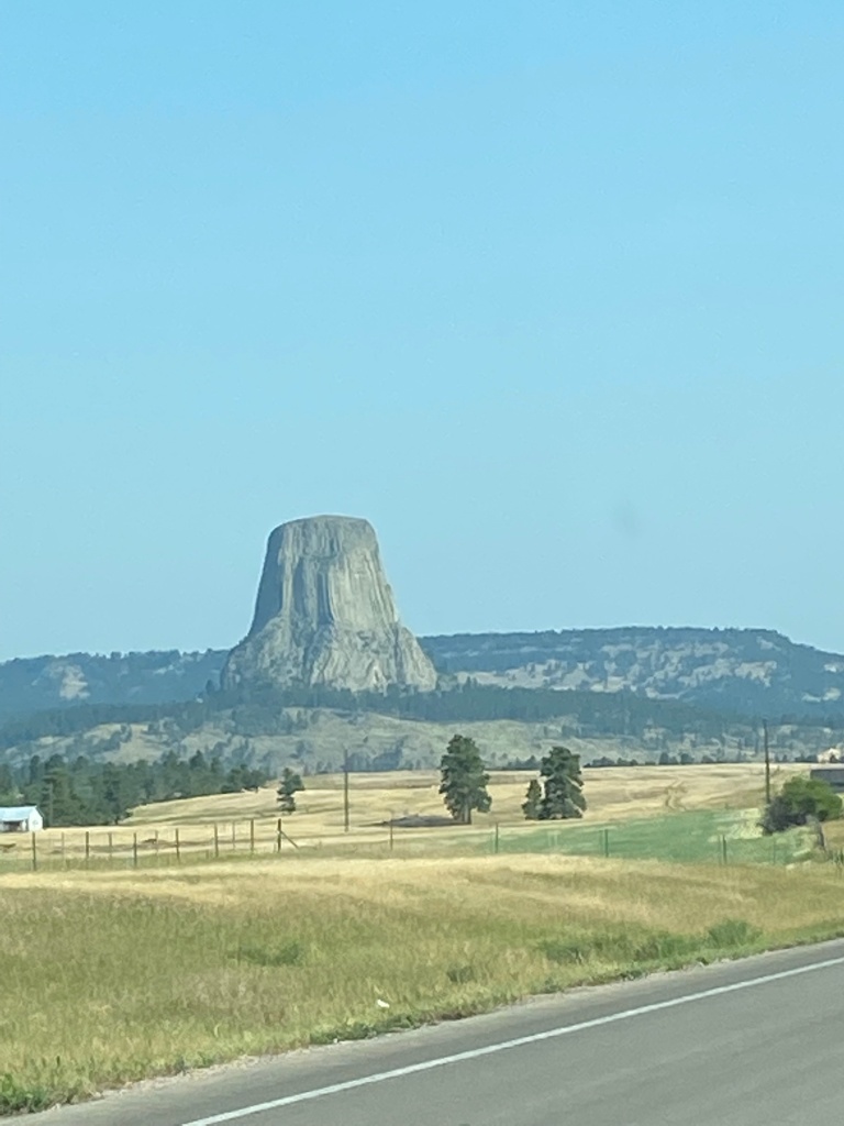
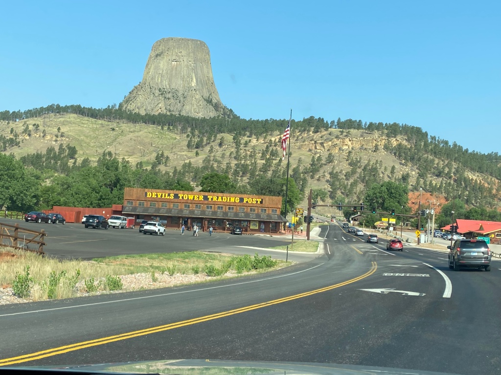
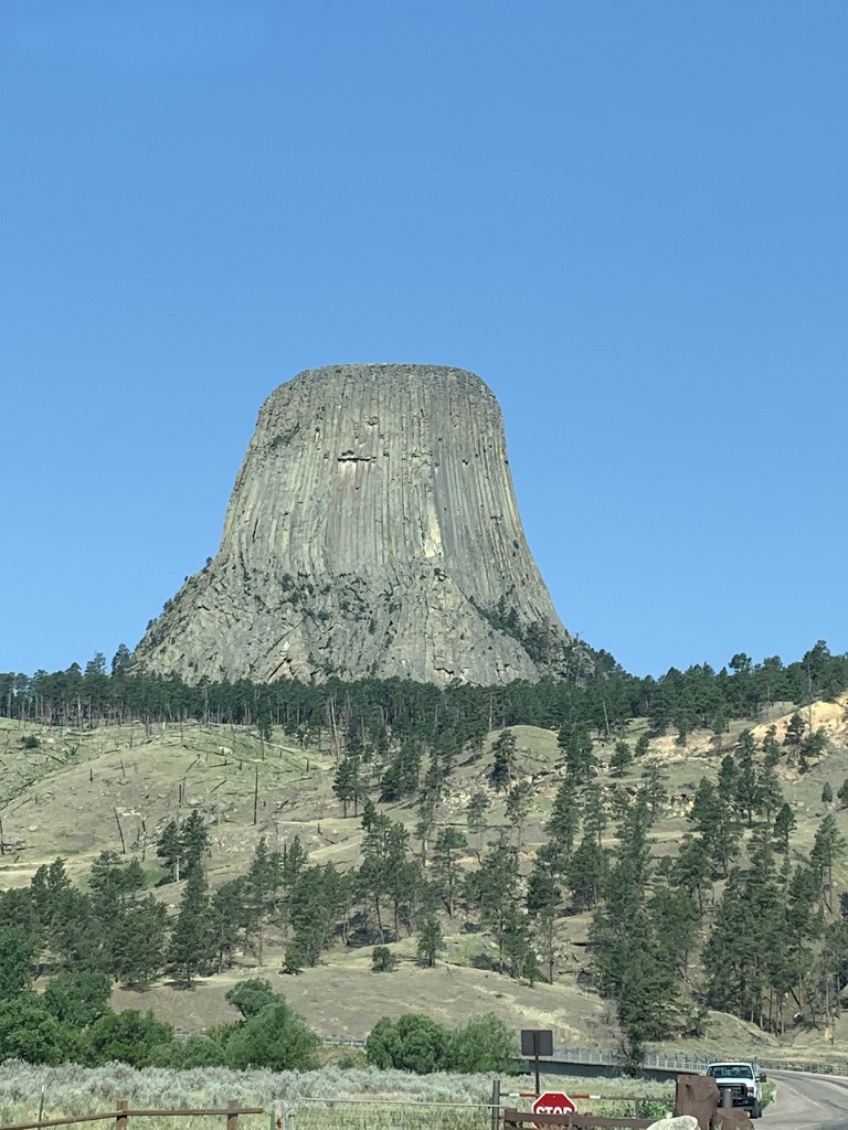
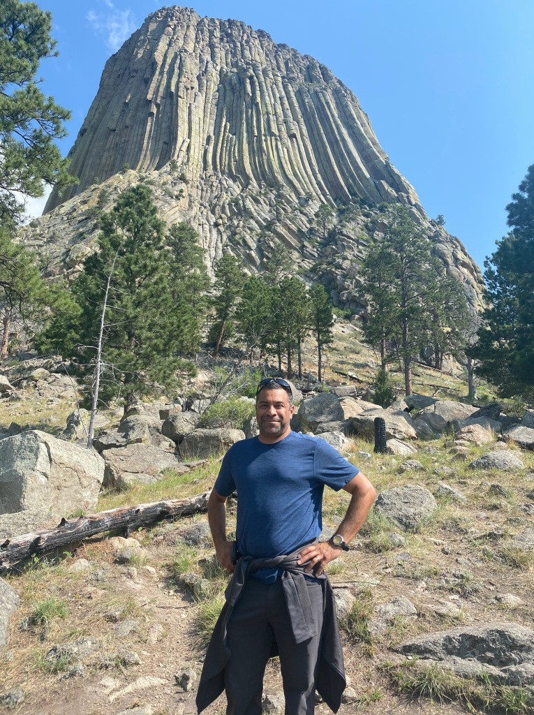
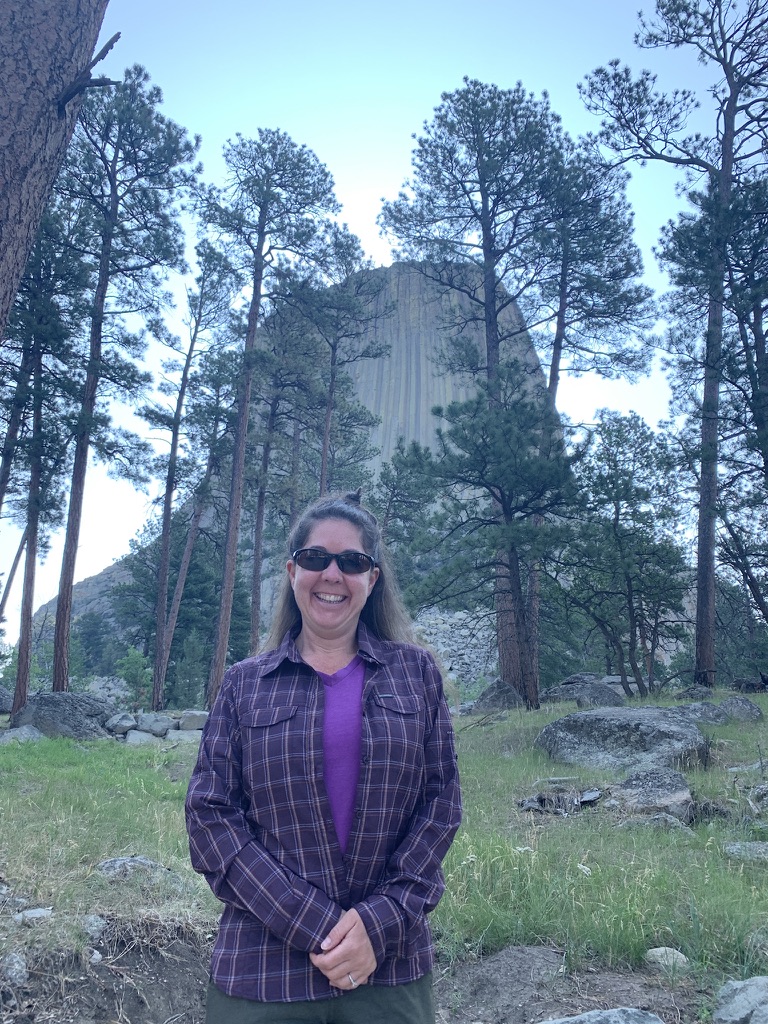
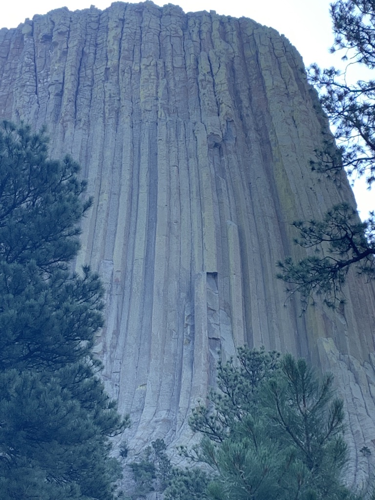
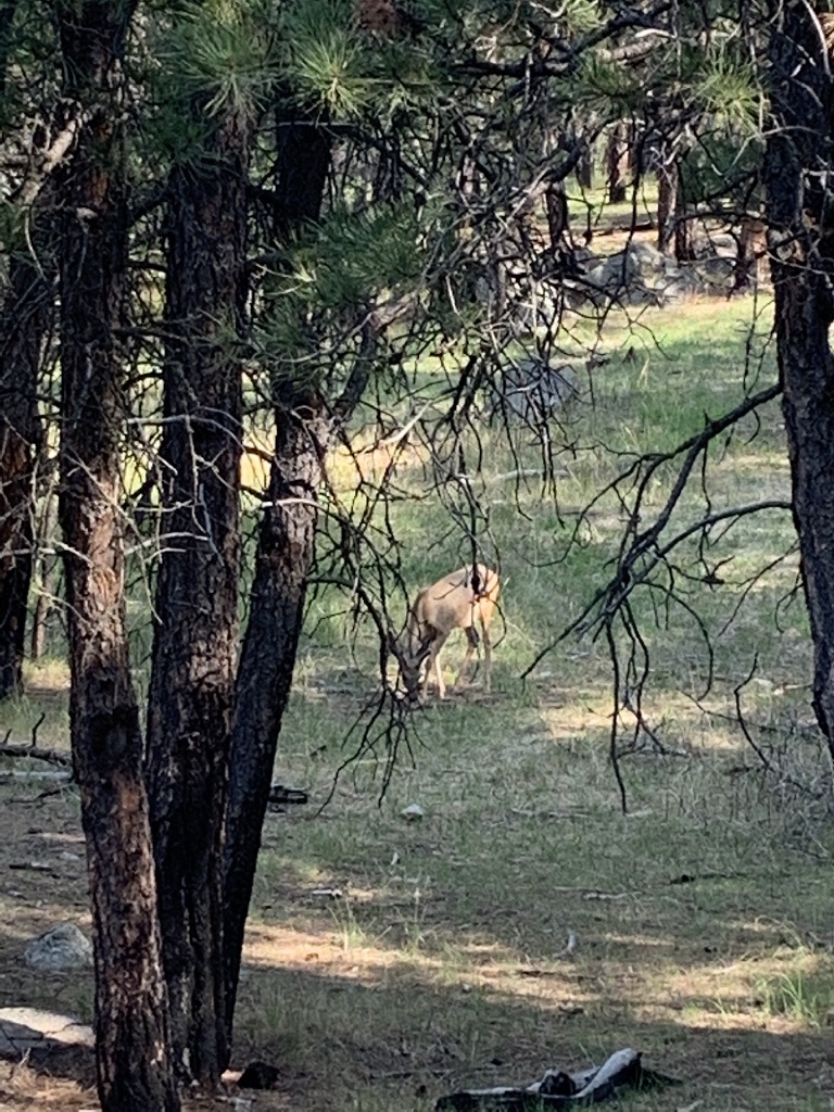
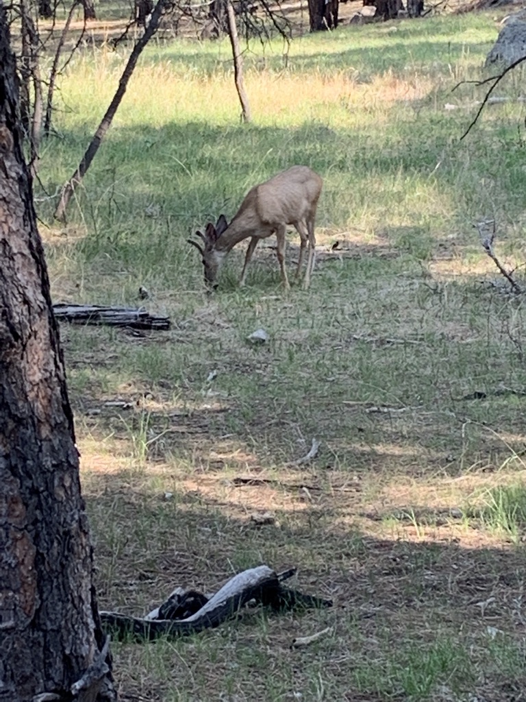
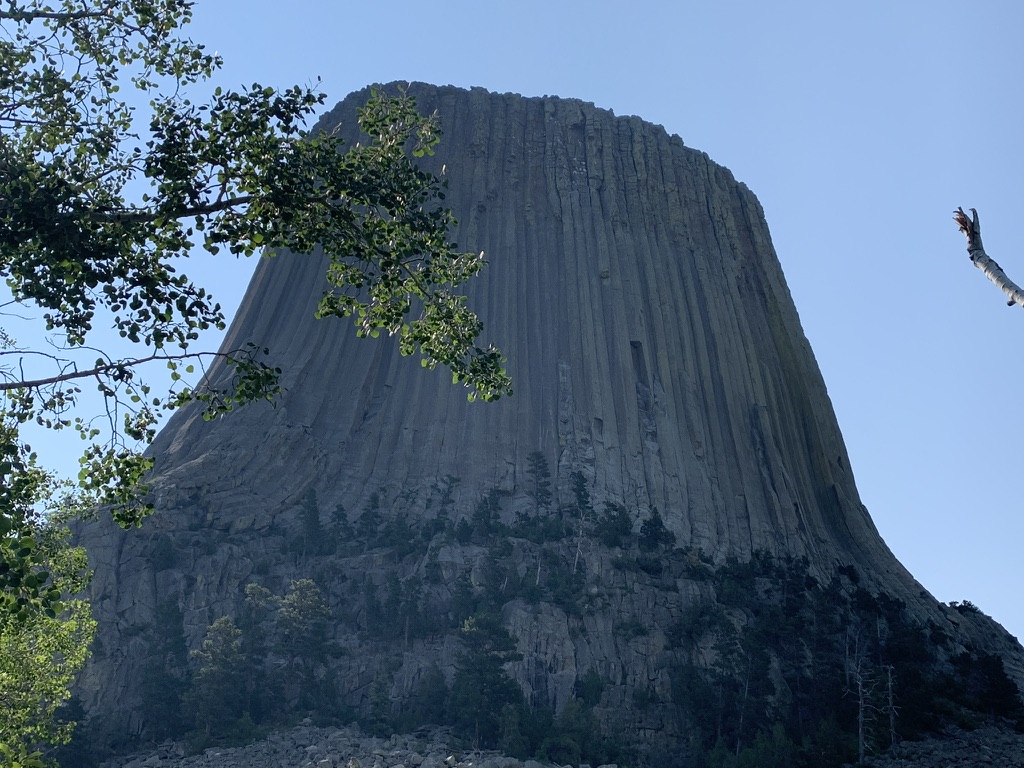
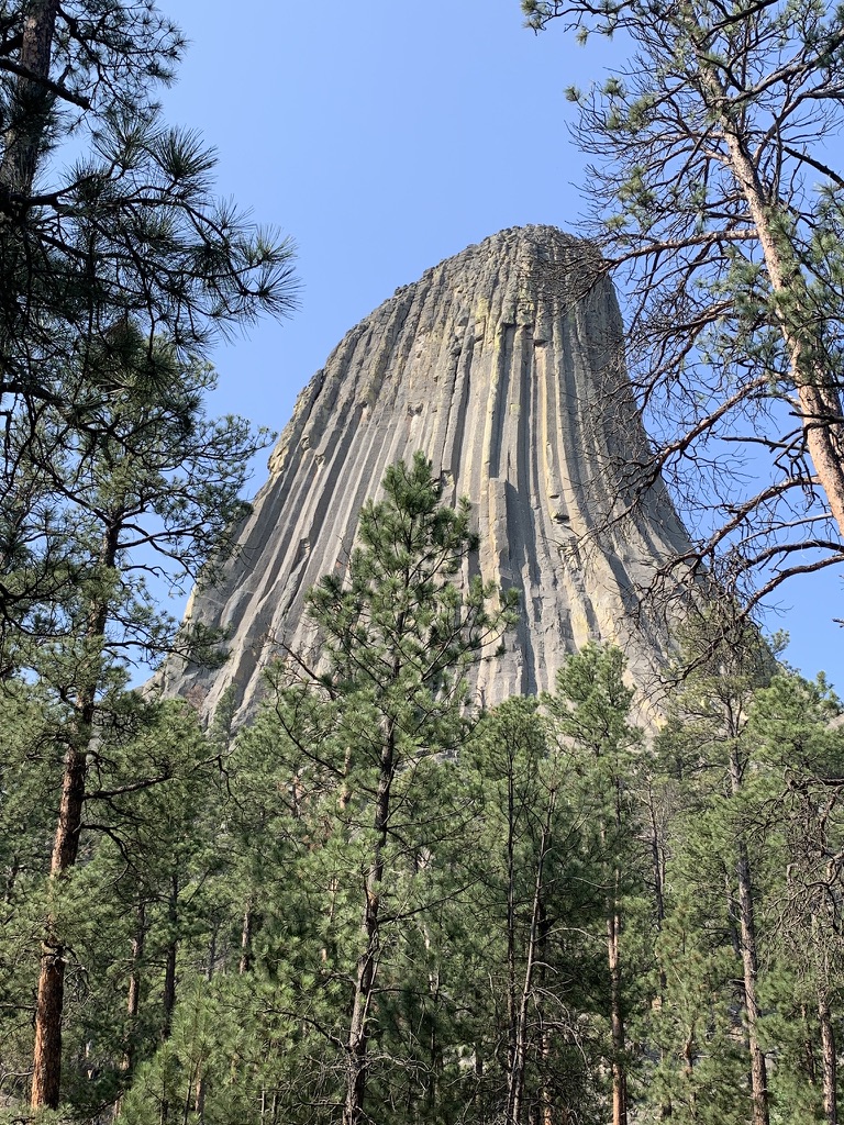
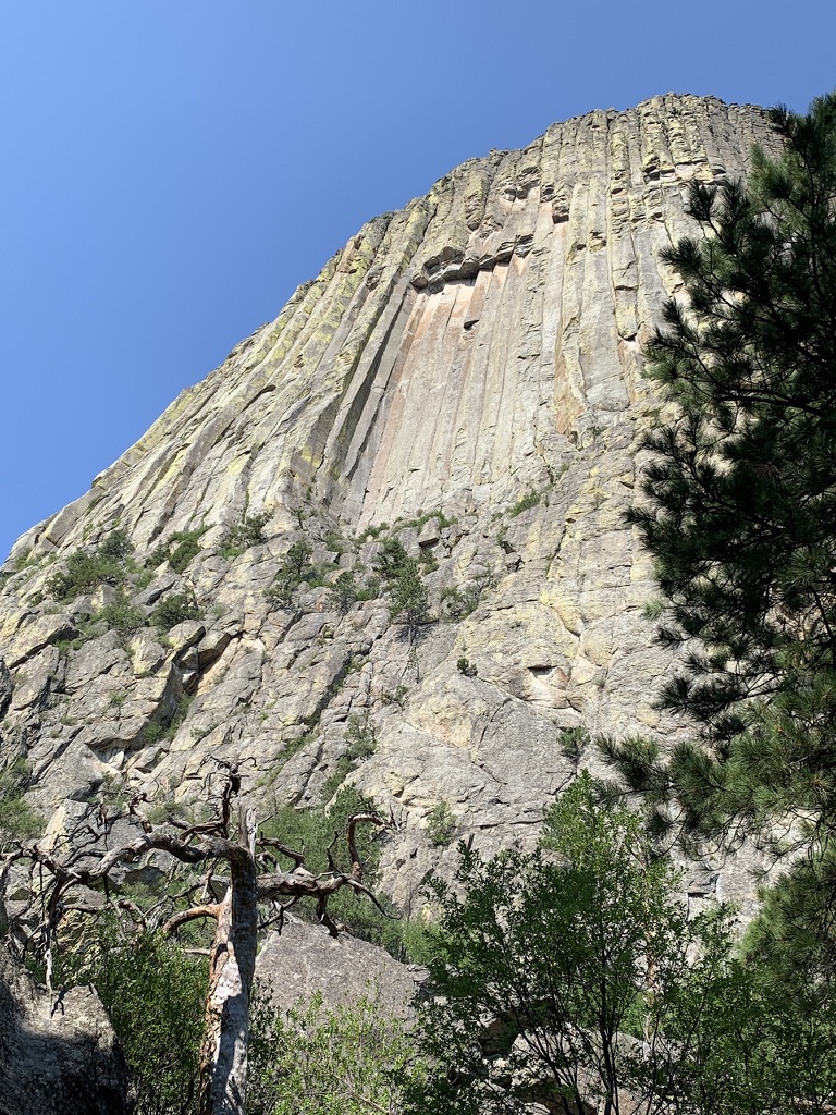
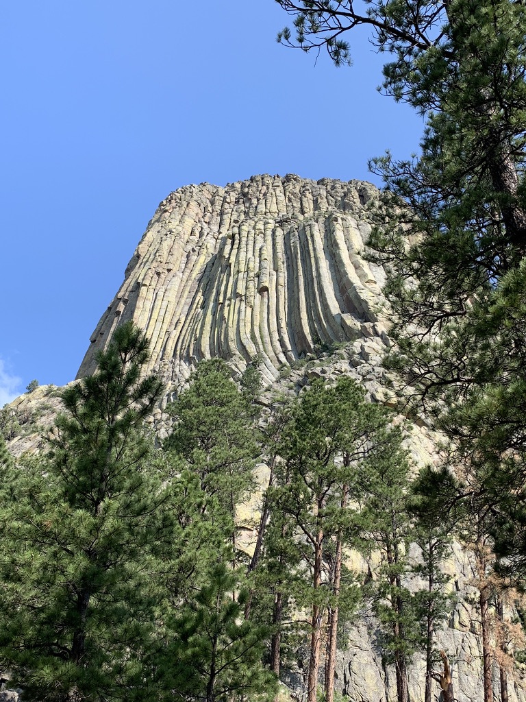
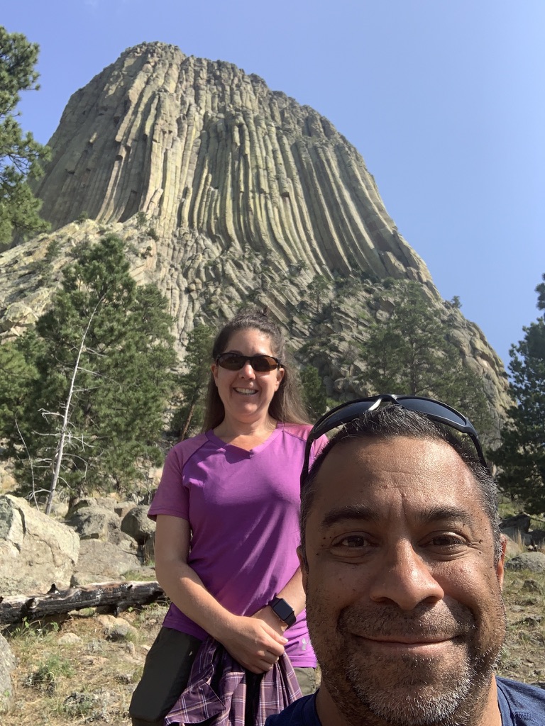
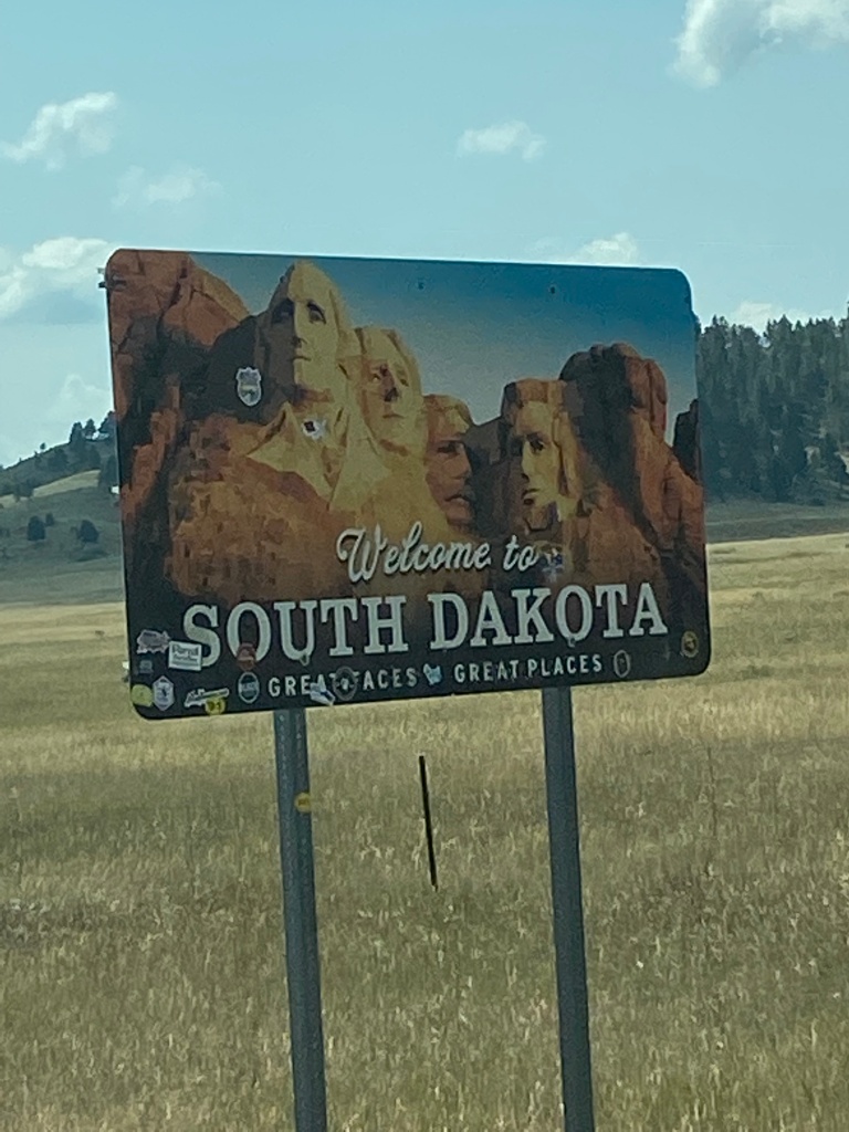
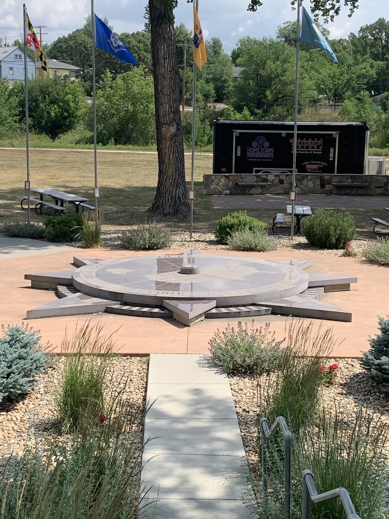
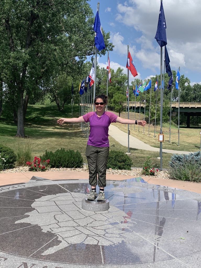
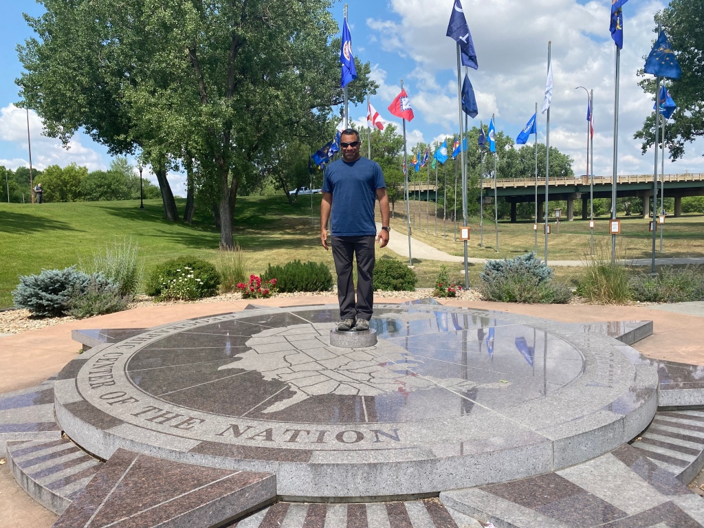
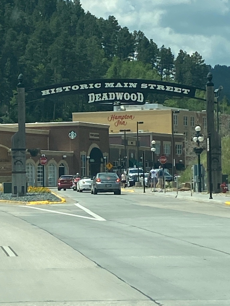
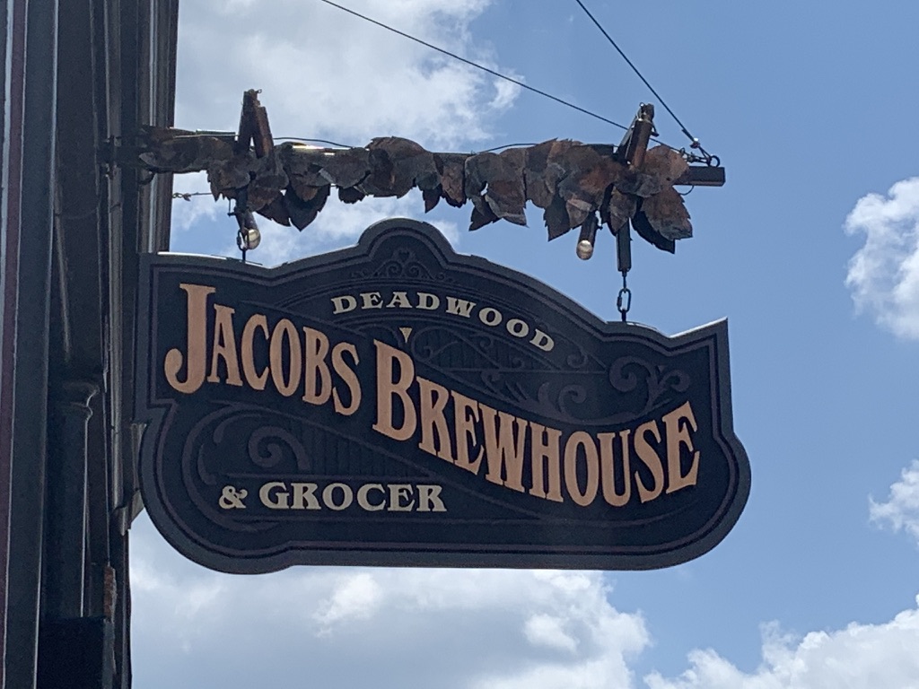
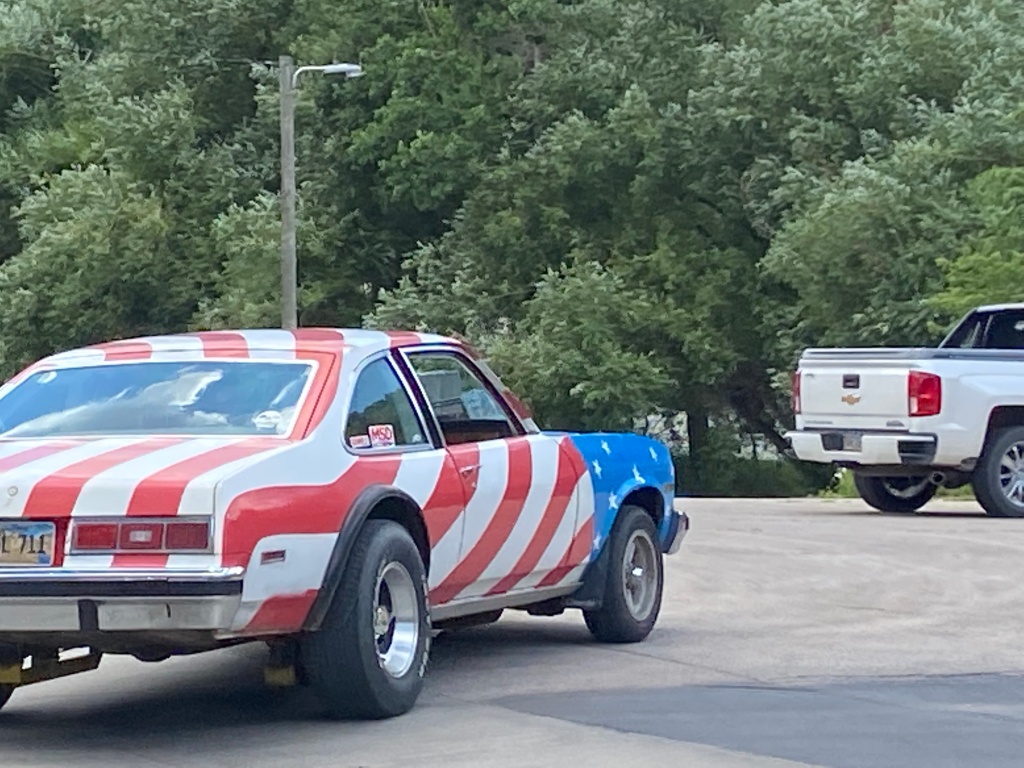
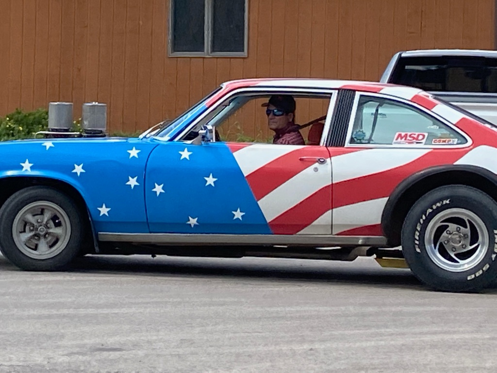
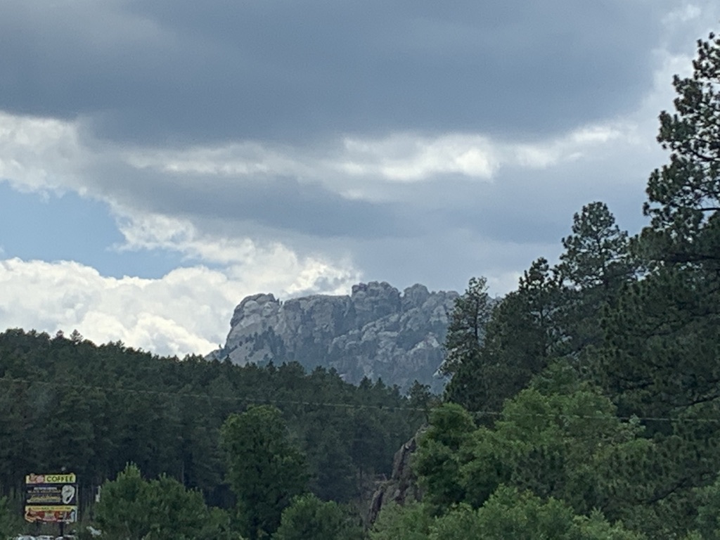
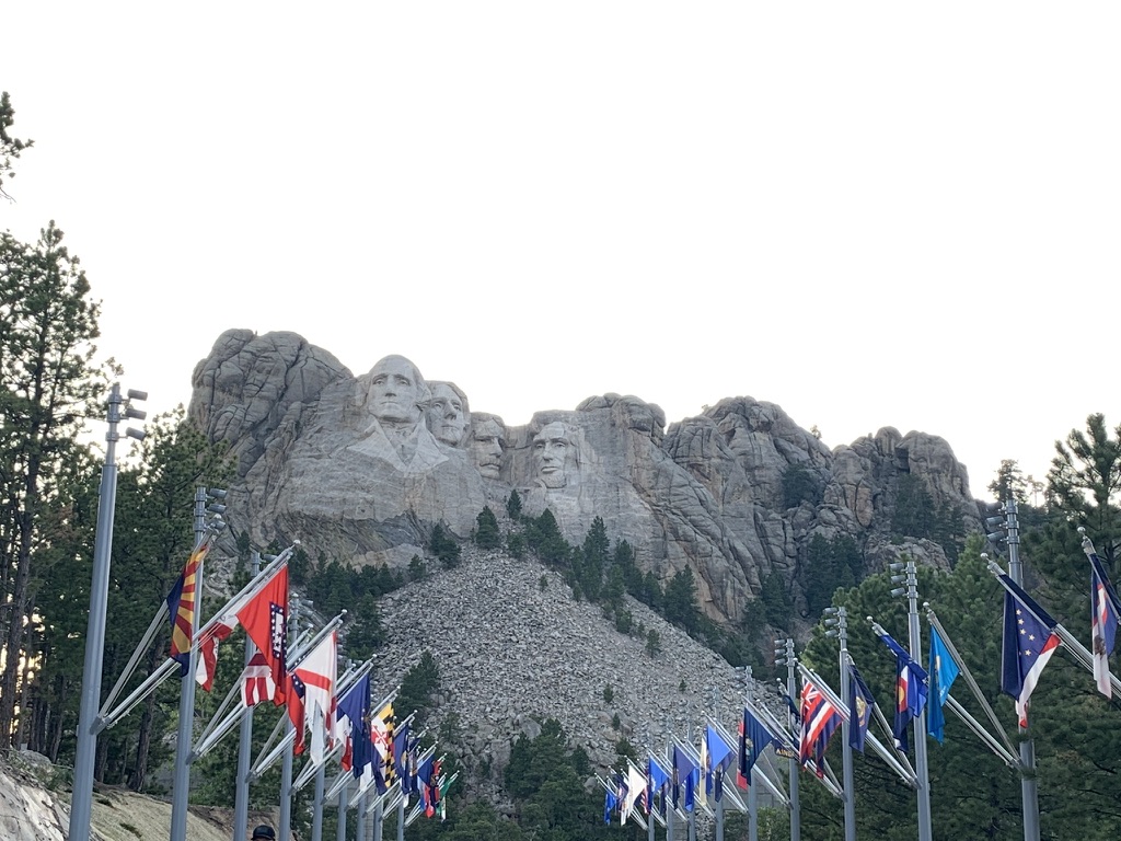
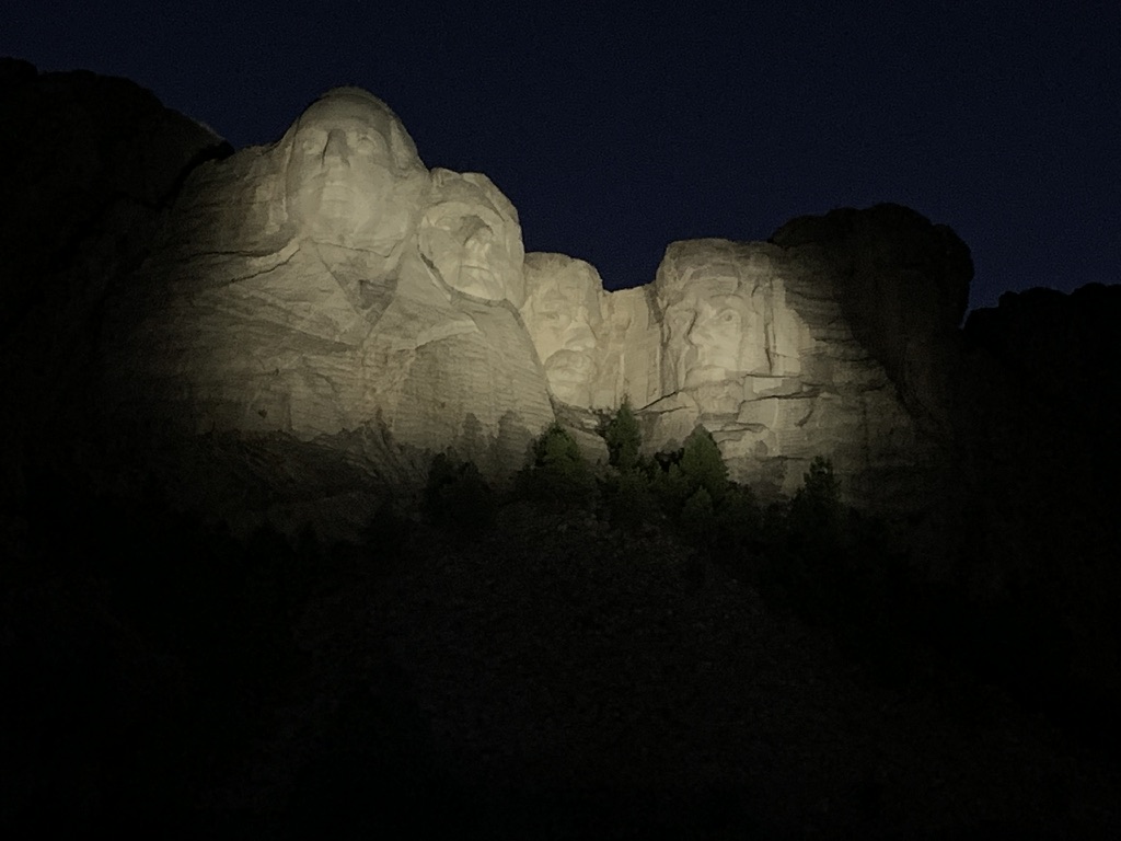
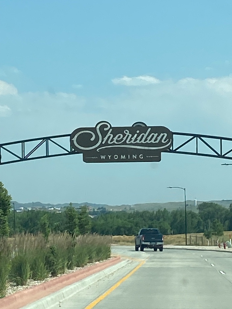
The view from our hotel room in Sheridan, WY. Boy was it an auspicious sign of things to come this stunning day!OK, not part of the auspicious start, but we’ve seen tons of these open bed train cars so far……cars and cars of coal.Things started to look up as we approached our first stop of the day and found these kids going for a ride on a tractor trailer. Future Farmers of America!Our first glimpse of Devil’s Tower Monument! The first national monument dedicated in 1906!Getting closer!And closer yet!Finally out of the car and starting the hike around the base!E’s turn!From every angle and in every angle of light, Devil’s Tower changes light! Now it’s the turn of the moss!Shh! Soon we stumbled across this young friend!This is from 20 yards away! Not afraid of humans at all! Okay, let’s move along!For something that looks so uniform from far away, it’s just different from every side!See what we mean!Pieces missing!Again a unique shape angle of the columns!Nearing the end of our short hike!State #6!In Belle Fourche, SD, the exact geographic center of the nation! All 50 states!E is at the center of not just S’s world!S’s turn!Deadwood, SD! Like the TV show, but nicer!Our lunch spot, naturally!Our way out of Deadwood, we spotted this patriotic automobile! Again a positive omen!Clearly we need another angle!Mount Rushmore in Keystone, SD! The view from our hotel parking lot!Avenue of Flags – just after the entrance to Mount Rushmore!Close up!We stayed for the ranger talk at sunset and the lighting of the Memorial! But the highlight is when the ranger invited all present and retired service members to help retire the colors for the day! At least 10% of the audience went to the stage of the amphitheater! Not a dry eye in the house! An epic way to end a truly great day!
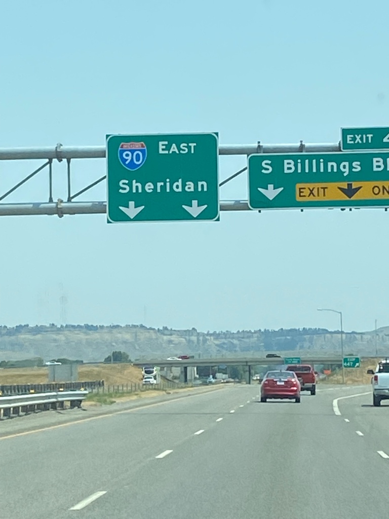
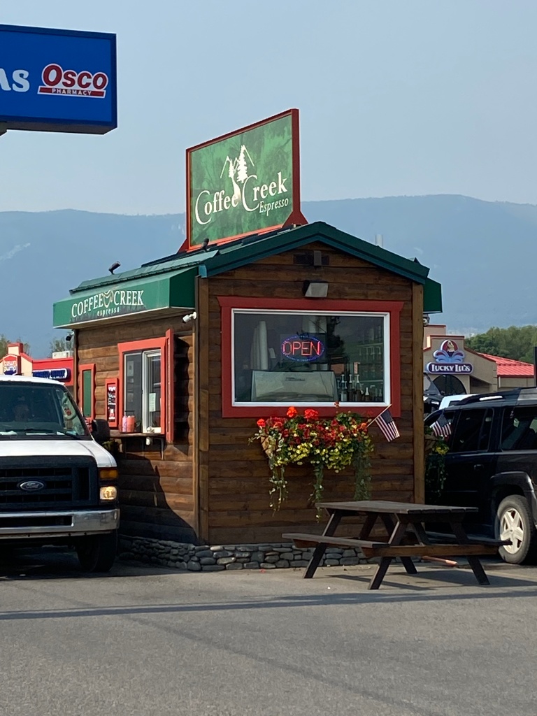
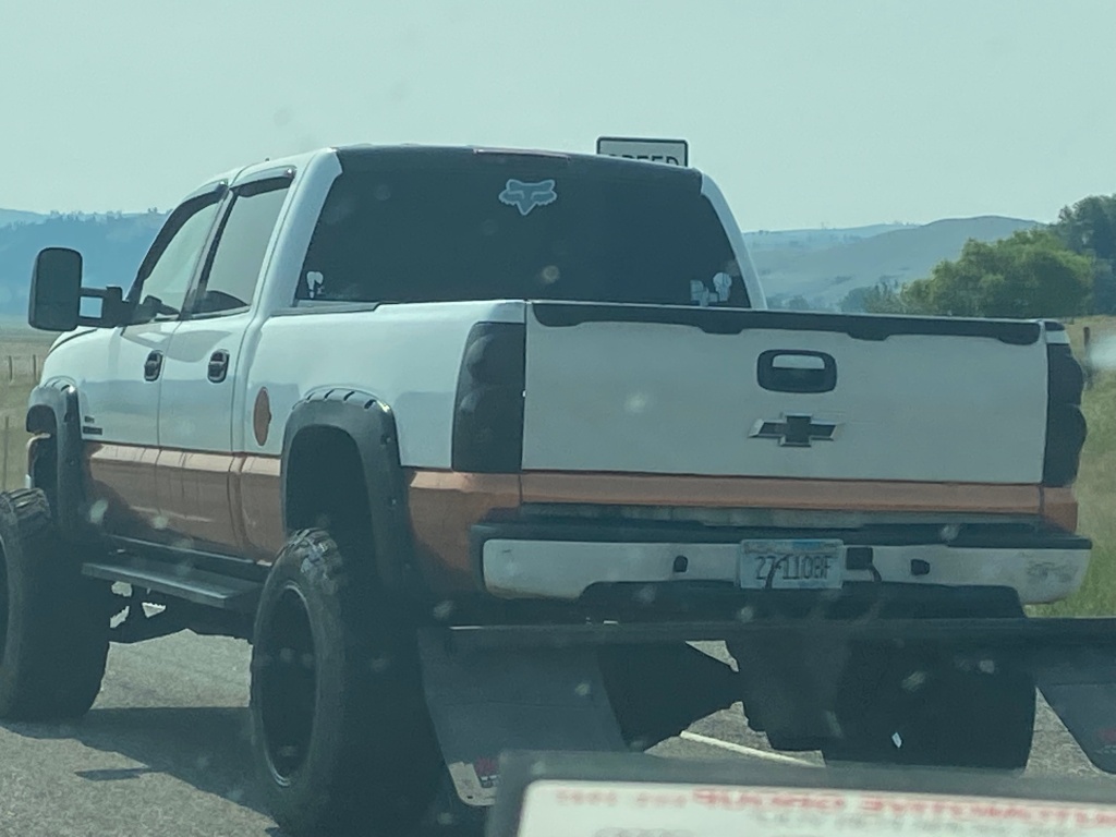
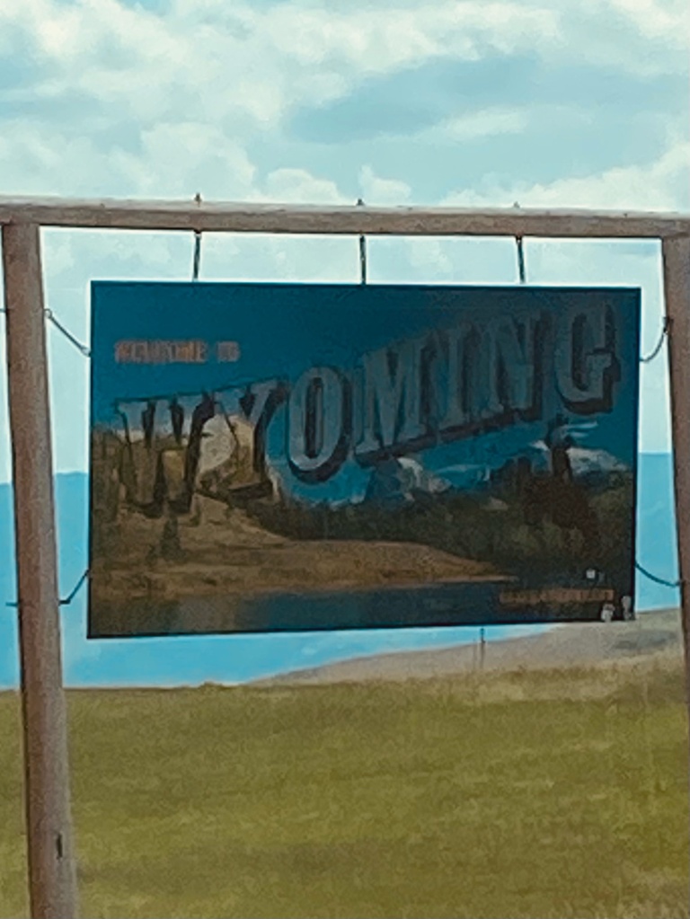
On to Sheridan……but first coffee…Dude put copper siding on his truck! OK, now we’ve seen everything!Brewery! Our lunch stop! In Billings, MT!Re-done beautifully two years ago, just in time for Covid! Still looks great!Huge outdoor patio with a special area for our animal friends!Cool glasses – we had to wait extra for the New American Lager on the right…time for the beer to settle! Made it’s debut this day!State #5!We made it safe and sound!Note the ominous clouds above the sign…for future referenceE’s taster
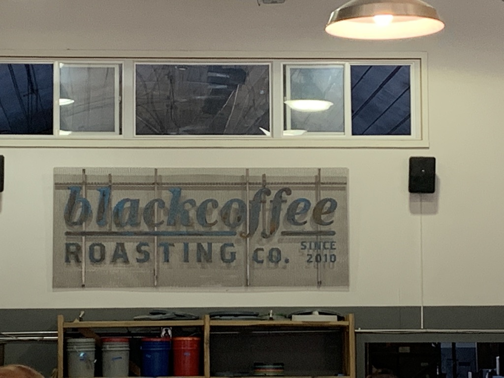
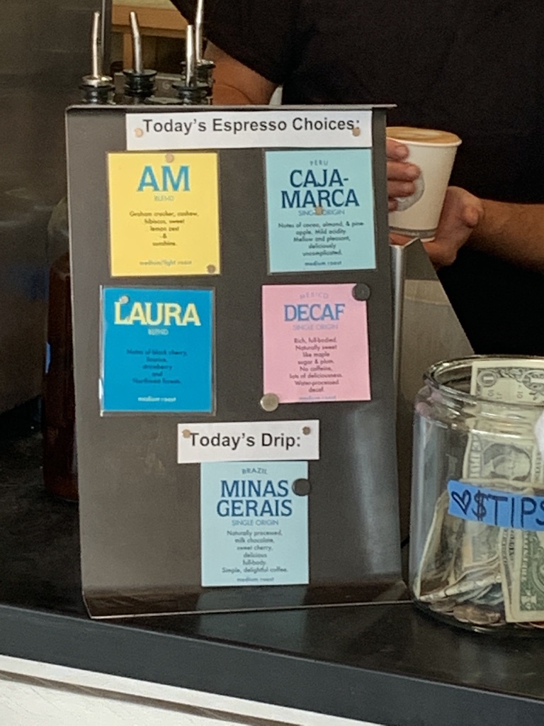
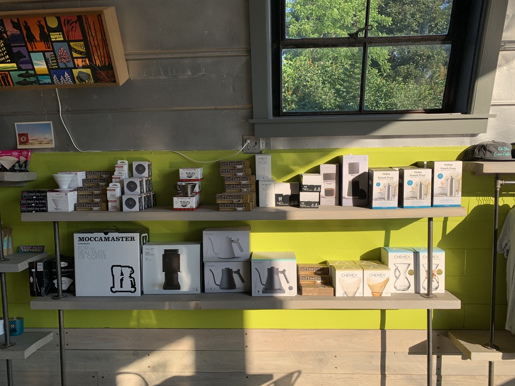
The day started right by finding the Black Coffee Roasting Company. These folks did it right. We had a choice of bean for our Americanos and the steamed milk was poured properly (no foam thank you very much). They also had a full variety of brewing technology (French Press, Chemex, range top Espresso makers, etc…) for customers to purchase.
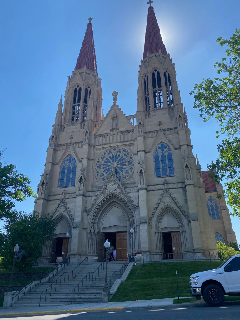
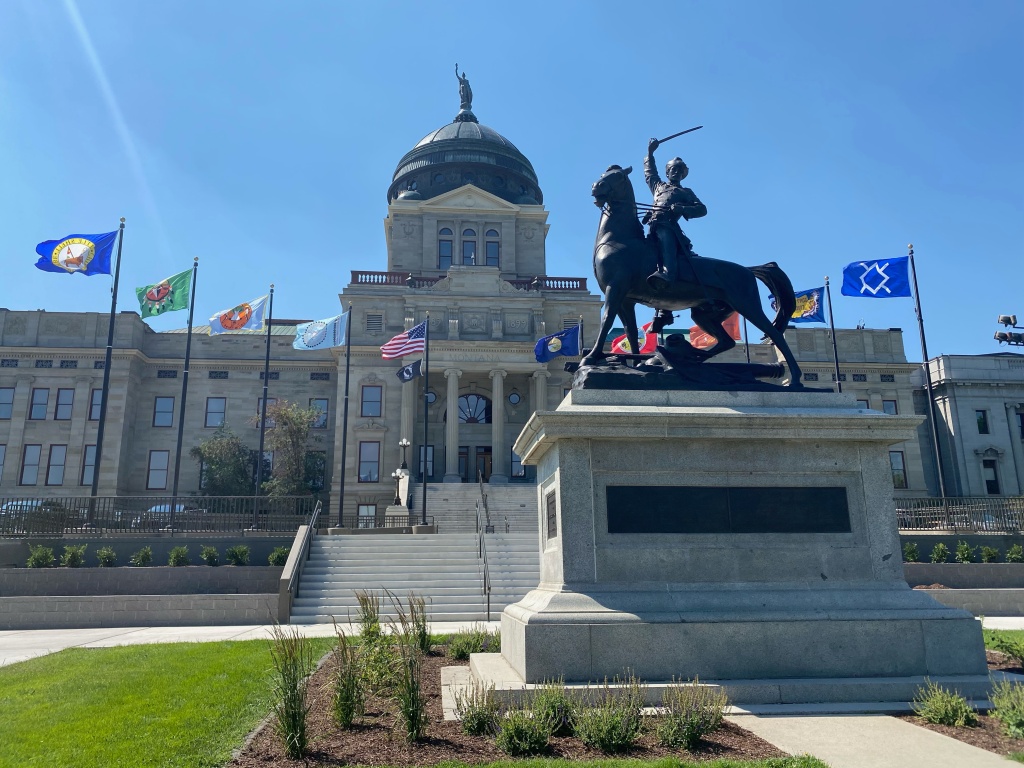
Next we had a decision to make, shorten the day and spend time in Bozeman or extend the day and head to the capital city of Helena. We opted for the later and found both the city’s glorious Cathedral and Capitol building. Good decision!
The sun’s corona adds something to photo, don’t you think? Especially to a holy place!The statue is of Thomas Francis Meagher – governor of MT after the Civil War. Read his bio Amazing life!
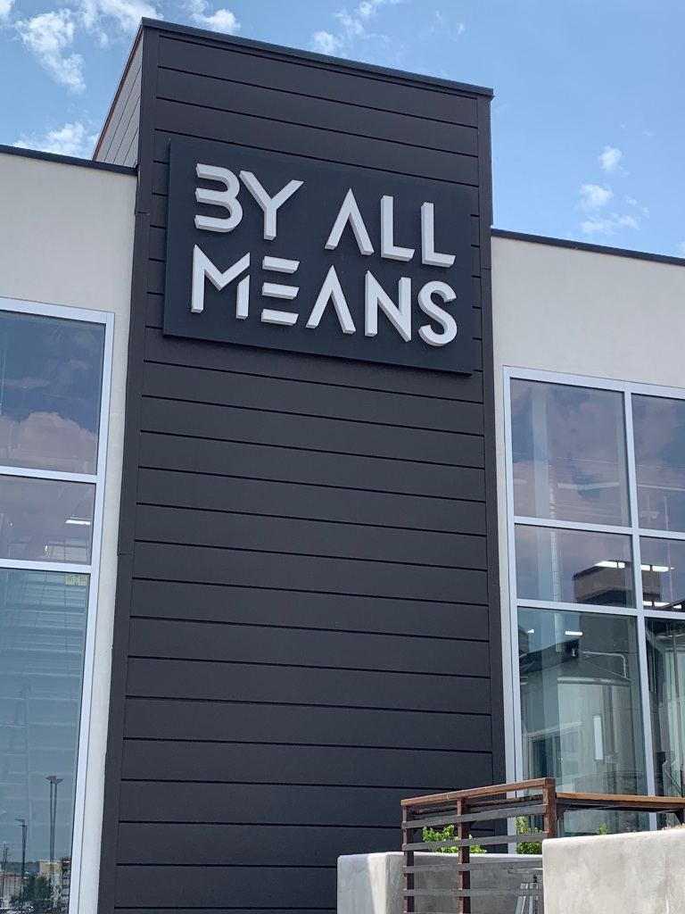
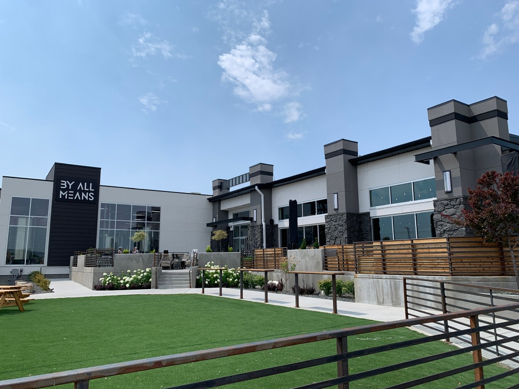
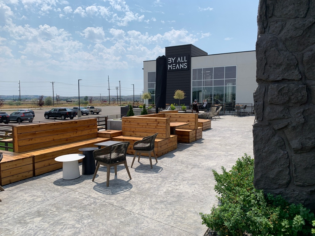
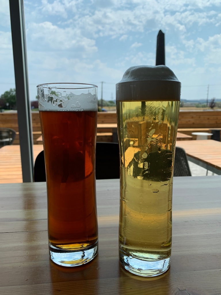
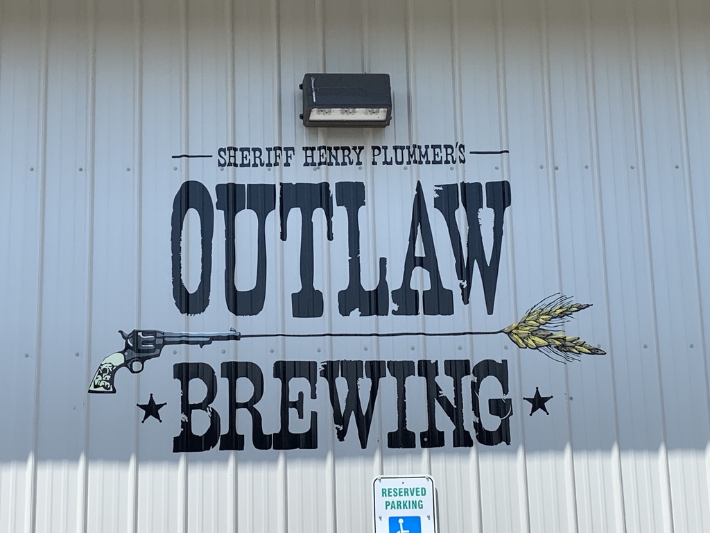
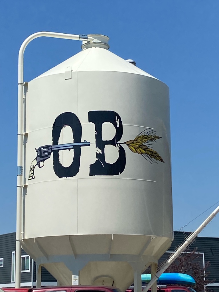
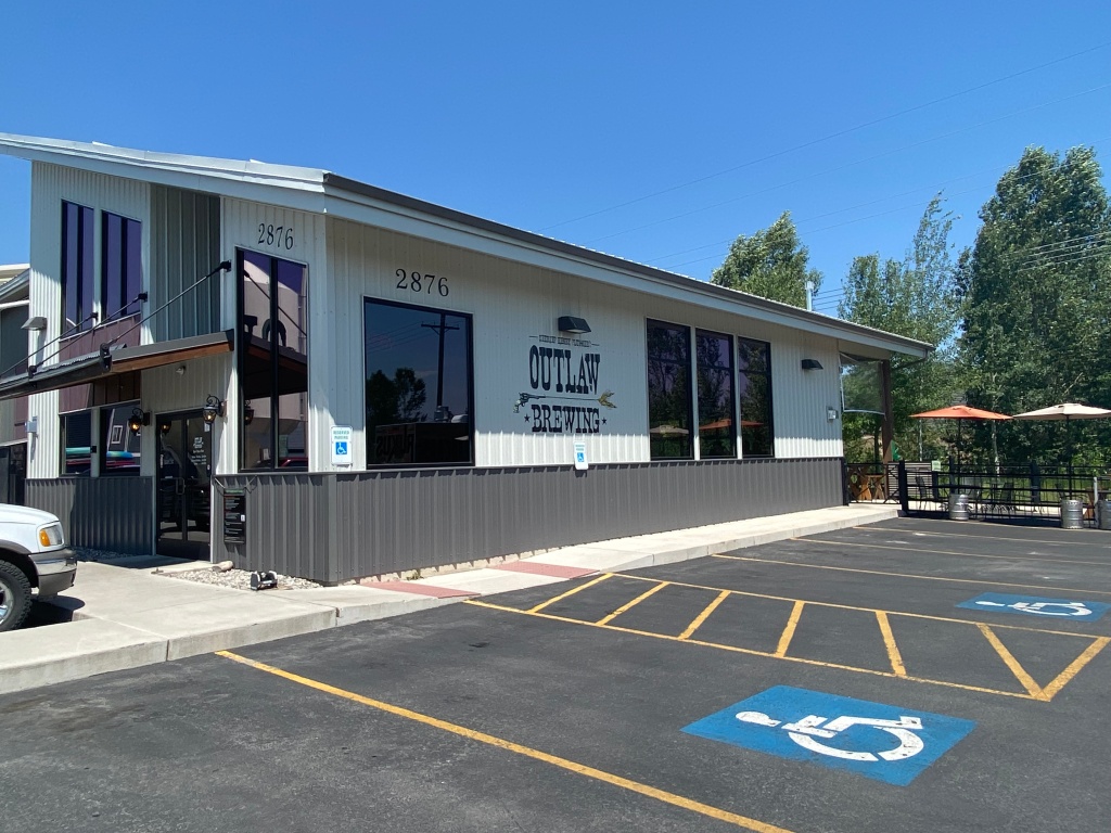
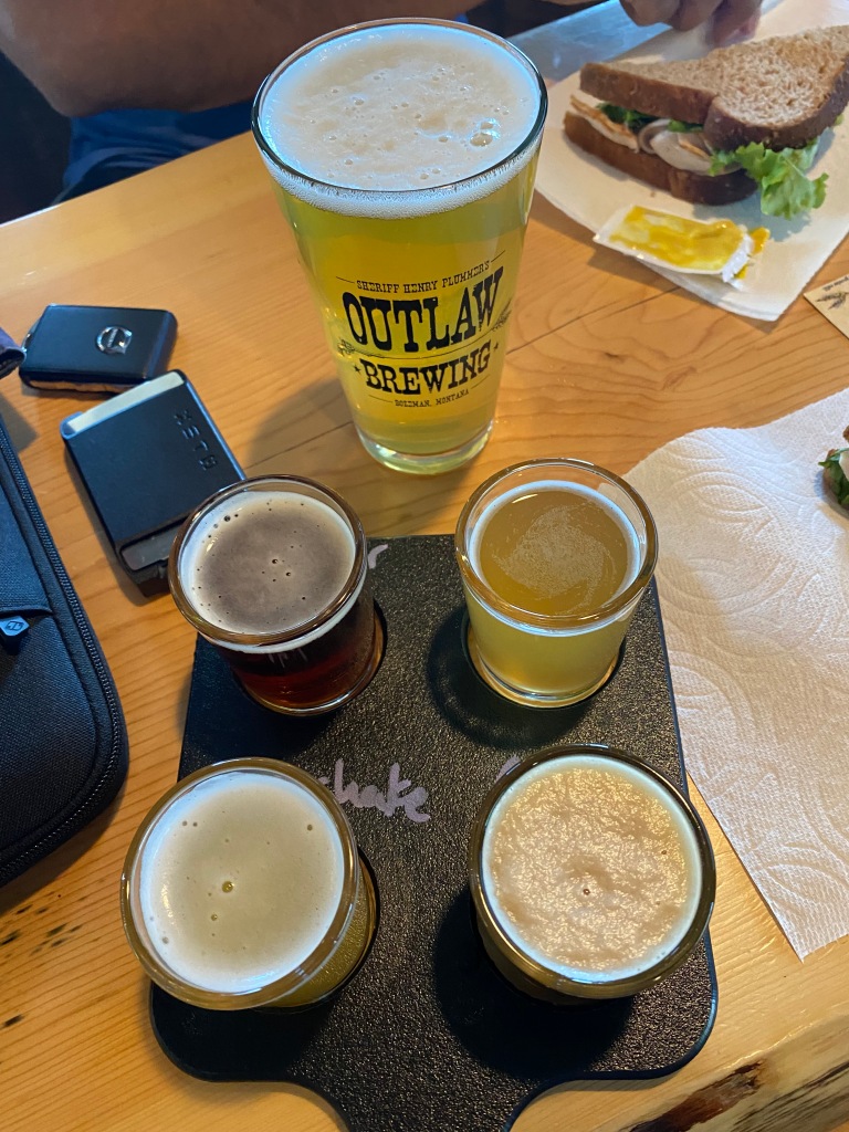
The rest of the drive was uneventful but we found our way to Outlaw Brewing.
This was our second day almost exclusively driving on Interstate-90 (excluding our detour to Helena). We are going to stay on 90 for the next few days. 6 days total. By the end we will have driven almost 1,200 miles just on I-90. Whew!
We started the day with a short 3 mile hike of medium exertion that promised excellent views of the lake. The hike delivered on all counts. We even made a new friend, who watched us but wasn’t scared of us. The aptly named Mineral Ridge hike even took us past a now abandoned mine that apparently showcases the style of mines used in the mid 19th Century.
After we left CDA, we bumped into this sign…
Fun for the Family! Year Round?!?
A recurring theme from our first 6 days is how dry the Western half of the US has become and the spiraling number of fires. This was brought home very clearly as we drove on Interstate 90 in Idaho. Again, the fires abutted the freeway. We saw numerous fire engines and firemen plus a very skilled helicopter pilot. We wish all the luck, skill and safety required to deal with this massive challenge.
Shaken by our fire experience, we decided to stop for a quick bite and some coffee. We found a cute coffee shop in Kellogg, ID. From the front porch we gazed westward and found the unsettling black smoke from the fire that we had just recently passed.
For years, S has been going to Starbucks and when asked what more they can do for me..he’s asked if they could make his coffee Irish. Sadly no comes the monotonous answer. Well S finally found the place to get an Irish coffee at a proper coffee house but sadly he was driving and couldn’t partake.
Sadly we didn’t partake!
We crossed over into MT from ID at about 5000 feet of elevation. That was a fun part of the drive.
State #4
Just outside of Missoula, MT, we stopped at Big Sky Brewing Company. We ordered lunch from the food truck and settled into the tasting room. Beers were first rate and very inexpensive. We had a 16oz Moose Drool (the brewery’s most famous beer) and a 4 beer tasting flight. We finished with 2 8oz beers to sample the remaining beers on our wish list. That entire experience of beer tasting cost us $13. Hello.
An American Brown Ale! Delish!
After arriving in Missoula, MT, we checked into our hotel and found our second brewery in MT! Conflux Brewing Company (h/t Aaron!). The beer names were quite clever. We enjoyed what we had tasted but our minds had already shifted to dinner.
We found a local grocery store and picked up a veggie sandwich. After a quick nap, we packed up the backpack and headed for the Clark Fork River, which was accessible through the Kiwanis Park. We walked down to the river and sat under the car and foot bridges. From there we had an excellent view of boaters and tuber floating down the river and teenagers jumping from the footbridge into the river.
Day 5 started with more time zone madness. Not really. There is a bridge just north of Riggins that the locals call the time zone bridge. North of the bridge is the Pacific Time Zone and south of the bridge is the Mountain Time Zone. We drove both ways to capture the signage. The people of this area take this stuff seriously, so we did too!
Driving north……driving south with the bridge in the backgroundAs if one needed more proof of how seriously this is taken!
We somehow missed the one coffee shop open early in Riggins, but found a cute drive through coffee shack a few miles down the road. It made us a bit homesick as S’s oldest niece just started working as a barista and the seemingly high school aged woman working in the drive through must have been the same age. Our Americanos with steamed milk were done to perfection and very hot!
A bit further up the road, we got super close to Washington State, maybe a half mile, but true to our mission, we stayed en route to Coeur D’Alene (CDA). Though we easily could have added another state (25th per our itinerary).
Squiggly light blue line is Sigrid, while the light gray horizontal line is the border between Idaho and Washington state
We also passed a very large lumber yard. The raw logs were being watered to keep them fresh. Sadly we missed the photo of the finished lumber sheets but you can see steam from the lumber mill in the background.
That’s just one photo! The mounds of logs kept going and going!
After finishing our drive to CDA, we went for a long walk around Lake Coeur D’Alene. Another vacation hot spot that attracts tourists from California, Oregon, Washington state, Montana and Southern Idaho. We found a neat lunch spot and learned that CDA is a haven for California refugees. Our waitress from lunch and from dinner were both from California.
And this is just one angle of the lake from CDA proper. The Lake has many fingers with more beaches and visitors. More from CDA in our next post.
Short day of driving but we had some insider tips on where to stop for the day. Starting to get a very good impression what makes Idaho a fun place to live and visit.
Today our companion for a good portion of our trip was the Payette River.
Because of our early start, we were famished early in the morning. Stopped at a roadside café named Gramma’s. Aptly named, it served breakfast favorites. We were served coffee in some interesting mugs.
Outside as we were parking, we saw a fun bumper sticker. Contrary to the tone, we have found everyone in Idaho to be delightful and interested in the quality of our experience.
Along the way to Riggins, we were told to stop at Lake Cascade. Rustic feel but looked like a great lake for a quiet vacation or some loud fun water skiing or other water sports. The area surrounding the lake didn’t seem quite so formal with some nice vacation homes and lots of green space.
After departing Lake Cascade, we ventured further north and bumped into yet another vacation hotspot – Lake McCall. Anyone familiar with Tahoe City in North Lake Tahoe would feel right at home. A lot more energy and far more active than Lake Cascade, but every bit the summer fun at the lake.
Everywhere we’ve gone in Idaho we see tons of these 4 wheel buggies. Golf carts for the more active set?
Believe it or not, we got stuck in a one hour traffic jam entering this town.
Maybe it was a sign of things to come. Because it was about to get weird, but first we ran across this important geo-marker.
This is now a photo blog. But. Some words are required. We came across some wild time zone madness. General statement. The more east you go, the further ahead in time zones you are. The more west you go, the further behind in time zones you are. Straight forward. Idaho and Oregon complicate matters. Part of Oregon is in the Pacific Time Zone and some of Oregon is in the Mountain Time Zone. Some of Idaho is in the Pacific Time Zone and some of Idaho is in the Mountain Time Zone. But its not what you think. See the color picture below. There’s a small carve out in South-Eastern Oregon that is in the Mountain Time Zone. The rest of Oregon is in the Pacific Time Zone. Idaho generically divides its Time Zone madness North and South. The Panhandle is in the Pacific Time Zone and the southern body of Idaho is in the Mountain Time Zone. So it’s possible to be in Idaho (east of Oregon) and be an hour behind. To further confuse things, there is a sliver (I-95 between Lake McCall and Riggins) of Idaho that you can drive where you slip between both time zones, while driving north-south. Make a big turn and the time zone changes. Come back the other way and it changes again. WEIRD, RIGHT?!?
Finally, Riggins, ID!
No doubt what this town is about!
While still in the Mountain Time Zone of Riggins, we went for a scenic drive along the Salmon River. We expected to find a bucolic hamlet in the middle of Idaho that was a haven for fly fishermen. What we found was still beautiful but a more parched landscape and the tranquil river that runs through it. We found a couple of sand bars on which you can camp for FREE so long as you take out your garbage.
We found a nice Elk farm. They were spooked as soon as we stopped the car and got out to take photos, but they still posed nicely for us despite their alarm.
We also saw some stand up paddle boarders shooting the rapids while we were checking out some of the sand bars.
We did a casual picnic for dinner with local crusty bread, some cheese, avocado, veggies and peanut M&Ms. Oh and some California Cabernet Sauvignon.
Happy 4th of July (belated)! The big event today was our first time zone change. We ended the day in Idaho – our 3rd state on the trip so far. Other than that the drive itself was fairly uneventful.
Boise here we come!
Before leaving Oregon (town of Nyssa), we passed a barn with the following sign. “Onion County USA.” We did a double take and drove back to make sure we saw the sign correctly. Who knew?
We’ve seen tons of animals so far. Mostly cows and sheep. We have seen some llamas and goats. We’ve also seen a lot of farms with these…
There are two north-south mountain ranges in Oregon. Once you get past the central Oregonian range, the landscape turns decidedly desert scrub. No trees, lots of bushes and other dry weather vegetation. We also began to see some unusual rock formations.
Welcome to Idaho!
Hello! Welcome to Idaho indeed! Never seen a speed limit sign listed at 80 mph! Sadly it only lasted a few miles.
Giddy up, Sigrid!
Our constant companion in Idaho was the Pole Creek.
We arrived at our hotel around noon after a quick lunch in Boise.
After dropping of our stuff, we headed for the excellent Barbarian Brewing. They make all of their own beers and we very much enjoyed their efforts. We think they have something for everyone but they really love their sour beers.
Love the sour heavy board! Well S did!
While enjoying our beers in the cool comfort of the A/C, we played games of Connect4(E won 2-1) and Jenga (a draw). We shared a table with a very young group from Reno, who were enjoying their adult coloring books.
S savoring his only victoryE shoulda been a surgeon with such steady hands……while S with his meathooks for hands!
While enjoying our beers, we had to take photos of…
Let’s call it the 4th of July exuberance!
At this point, Sigrid demanded we go visit her countrymen at the Mad Swede Brewing Company. Alas they were off for the 4th?!? Mad indeed
We switched gears (ahem) and headed for the Meriwether Ciderhouse. We sampled two tasters – an all Meriwether flight and the top choices of the employees. We enjoyed 9 of the 10…only one sad top choice didn’t pass muster.
After a quick nap and delicious dinner, we headed for the Ann Morrison park. We were told it was the place to go to watch fireworks. It’s a big park, so we were a bit concerned that we wouldn’t be able to find the proper field to watch the show. While crossing a main street, we saw one of the best sunsets we’ve seen (maybe since the Darwin, Australia when grass fires made a perfect sunset). The first of Northern California and Southern Oregon. Probably had the same effect.
Yes, we’re standing in the middle of the street with cars coming towards us.Tail end of sunset as we crossed the Boise River
As we entered the park, we were joined by hundreds of people carrying chairs and coolers. No chance of getting lost. The official show weren’t the only fireworks as attendees brought their own sparklers – some small and some spectacular.
Last item to mention in Boise – there are old timey tractors positioned around town. Most have no security measures aside from velvet ropes. One set up did have the tractor behind a glass box – which made it difficult to photograph. Very cool.
Got an early start and headed to Crater Lake (we even beat the rangers to the park). The Lake was totally still – not even a ripple. Epic! The conditions made for great photos of reflections from the far side of the crater. We even saw the reflections of the wispy clouds overhead in the Lake.
Glassy conditions!Perfectly still with cloudy reflections! Plus the colors!
We also had a brilliantly sunny day to see the deepest lake in the US and the clearest lake in the world. We hiked down to Cleetwood Cove (the only way to reach the lake’s surface) and touched the surprisingly not freezing cold lake.
The hike is the equivalent of 65 flights of stairs – lotsa switch backs in 1.1 miles each way!The small dock marks the end of the hike.
We got some excellent views of Wizard Island.
The colors of the Lake are stunning – thanks to the water clarity.
We also drove the circumference of the Lake to get different views. The highest point was about 7640 feet.
After leaving Crater Lake, we drove to Bend, OR. Thanks to an insider tip from E’s brother and his wife, we headed to Mackay Cottage – their first and only suggestion on where to eat in Bend. The restaurant is open from 7am-2pm. We got there at 12:30pm and had to wait 35 minutes for a table! Great food and vibe…aside from a lady falling down the stairs and hitting her head on the ground. Required emergency services assistance. Fingers crossed that she’s well.
As we drove from Mackay Cottage to our next destination, our attention was grabbed by this. E’s brothers were upset that we didn’t enter and peruse the store (they mostly sell memorabilia we’re told), but we decided to press on. Some of you have no doubt seen the Netflix documentary, but to see it in person was something else.
After driving past the relic from the past (good riddance!), we made a quick stop to Silver Moon Brewing. We tried two beers. The F* Cancer IPA and their seasonal Grapefruit flavored beer. We loved the Grapefruit beer but the charity driven F* Cancer won us over.
The beer at Silver Moon was great but we were mesmerized by their hand painted mural. S’s favorite band was featured in the mural. Yes!
As a side note, everywhere you look in Oregon is a snow-capped peak (even this time of year!) or a wondrous jagged peak.
We felt these mountains and there friends were following us all day!Union Peak – while driving around the caldera at Crater Lake
E finished the day by driving from Bend to Burns, OR. No fires blocked our progress, so we arrived without incident.
Day 1 is likely to be our longest day of driving on this whole trip. Due to two fires near the California-Oregon border, we had to make some route changes. S chose poorly. We got lost and ended up on a steep and loose gravel track that made a long day even longer. But memorable.
In Hindu philosophy, Ganesha’s spirit should always be worshipped or invoked prior to important events. As such, Ganesha will always ride shotgun in our car.
As we entered I-505 and began our northward journey, we encountered some hot air balloons that were finishing their journeys for the day.
We enjoyed some homemade breakfast at a gas station. To be clear, we ate breakfast at a gas station but the food was not from the gas station. S’s mom makes the best poha and chivda (I accept all challenges on her behalf) and it was a delightful way to start our journey. Thanks Nani!
As we drove north, fire and smoke were everywhere. We could see the firemen carrying out their important duties. We encountered a group finishing their day at Mount Shasta Brewing Company. We tried to buy them a round, but they were not permitted to drink while in active service.
Mount Shasta Brewing Company. Our lunch stop. Our favorite beer was the jalapeno flavored beer (proper name is the Weed Jalapeno Ale). But they serve it two ways. With a pickle and without. It’s better with a pickle. Yes. We were surprised too.
Jalapeno Ale – Without pickle on the left, with pickle on the right
Beer emergency, who ya gonna call?
We climbed Mount Lassen about one year ago, but we never tire of seeing the massive Southern face.
From Weed, California (yes it’s a real place), we were planning to take I-97 into Oregon. Due to fires and closure of I-97, we had to abandon the plan. S re-routed us onto a route selected from options presented by Google maps. He chose poorly. Turned a long day into a longer day, but no harm no foul.
Sign outside the Mount Shasta Brewing CompanyDecorations in the Mount Shasta Brewing CompanyLoose gravel track!
Hello Oregon! No Goodbye from California? How rude!
Our dear friends, Anne and Aaron, were on their own epic driving day. They drove the same route we did. Except they left at 1:45am and drove all the way to Battle Ground, Washington. They were about 6 hours ahead of us and called us as they were crossing into Oregon. Very sweet of them to wish us safe travels on our long driving trip. They’ve been incredible friends to us over the past 15 months and helped to keep us sane. FYI…their blog from their own sabbatical served as inspiration for our own conversion to a picture driven blog.